
While you can drag and drop images quickly and easily to a location in Lightroom, it’s much more accurate to use a GPS device that creates GPX tracklogs.
With the advent of Lightroom 4’s Map Module, I’ve had a few developers contact me about their apps for iOS that do just that. So this post is going to mention one of them briefly, but is really about the tracklog feature in the Map Module. I’ll look at others in the future.
Geotagr is one such app from Galarina. It’s $4.99 and pretty comprehensive, but I’ve barely scratched the surface. When you open the app, it gives you a time to sync your camera with. It’s a GMT for me, but I’m GMT anyway right now, so I’ve not ascertained if it’s GMT for everyone. GPS records in GMT anyhow, but it can be disconcerting for time offsets.
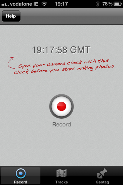
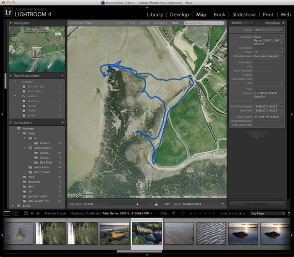
Press record when you get to the location, and press the stop button on the top right to stop when you’re done. You can pause too via a button on the right. Below is my completed tracklog.
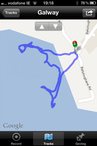
It looks like I’m out to sea, but I’m really just on the beach. The satelite view actually show the beach at a lower tide that I’ve ever seen it personally.
Using the output icon on the top right of this screen cap, one of the options is export to Dropbox. I didn’t even need to configure Dropbox and this worked.
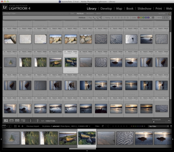
When I got home, I imported my photos into Lightroom. The day itself wasn’t great, and I did manage to accidentally shoot at ISO2000 for half the time too! It’s not that bad really.
From there it’s into the Map Module. Clicking the Tracklog icon-that’s the last one in the Map toolbar, I choose Load Tracklog from the list. I go to Dropbox, and find the tracklog in the Apps/Geotagr folder, where I select it. Obviously this applies to GPX from any GPS device. If your device doesn’t support GPX, you can convert using GPS Babel.
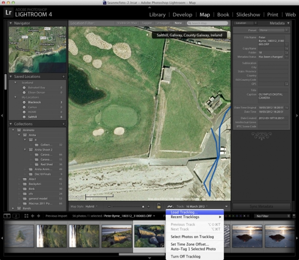
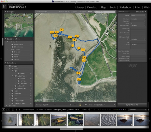
This automatically places the map at the tracklog location and shows it on the map.
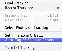
It matches the one from the phone in a reassuring way. To get the image onto the tracklog without too much hassle, first select all the photos, and then choose ‘Auto Tag X Selected Photos’, where X is the number of photos.
The photos get placed on the tracklog based on matching the times to the tracklog times. It’s all rather neat. Now if only there was a way I’d remember to bring wellies.
There’s many more features in Geotagr, but the important ones for me are the ease of recording and getting the GPX files onto the computer to match with the photos.


Sorry I’m posting on an old post, but I’m looking for a geotag app for iPhone that’s current. I’m afraid this one is discontinued because it’s using the old look and feel. I don’t want to spend 5 bucks for something that will stop working with an update to the phone OS. According to this review (http://www.disturbancesinthewash.net/journal/geotagr-review-iphone-app-to-geotag-photographs) it works fine in the new iPhone, but I’m still not sure. Do you know of any apps that do the same thing but are in active development?
Hi John, I’m still on iOS6, so I can’t answer that.